Ready or Not...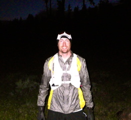 I've run 100 miles one single time in my life. Last August. Cascade Crest 100. It took me 28 hours and 14 minutes and was one of the best experiences in my life. Taking on the Mogollon Monster 100 as a new race in a new location for a new race director was admittedly an ambitious task but one I've taken very seriously and passionately. Passionately enough that I decided last fall to run the entire course from start to finish. 106 miles. Self supported. It was a self challenge I was more than up for and I trained hard all fall for the December 10th date. The week before came, the nerves started and then the snow came. And it never left. 24" dropped the week before the 10th and the temperatures never lifted and winter was officially in Pine, Arizona. It hadn't snowed on that week in over 6 years. So we pushed back the running of the course to May 5th, 2012. So the training began once again. Zane Grey 50MTwo weeks before I helped volunteer at the Zane Grey 50 Mile race with RD Joe Galope as training for directing the Mogollon Monster 100 this fall. Zane Grey has three common aid stations as the Monster and it would be invaluable experience for the fall in planning, access and a general understanding of the area in terms of logistics versus trails. It was a very long day but a very memorable one. I made this video on the experience and race itself while I was helping out. Have to Start SometimeMay 4th arrives and has me staring at the ceiling of the Super 8 in Payson, Arizona trying to fall asleep knowing that in just a few hours I'll be starting the longest day of my life. Voluntarily. With no buckle at the finish. No competitors. Nobody to push me. 100% mental determination. The morning came finally and my good friend Jay Danek and I headed out for the Pine Trailhead in Pine, AZ, twenty minutes north. Pulling in right away four elk stood guard in the parking lot, seemingly unfazed by the lights of my truck. Eventually they darted off and we started to prep for the morning. We took a few pictures and broke for the trail at 5:01am. 106 miles to go. 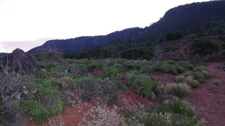 The course starts out with an eight mile climb up the western side of Milk Ranch Point, a large plateau of the Mogollon Rim that forms the barrier between the start and the rest of the course. Runners head up the Rim along this trail traversing the side of the cliff, up and down, through a variety of forest and cactus before reaching the base of the cliff. From there Jay and I started the climb up the Rim to the top, a 2,800 foot climb in the eight miles, nearly all of which in the last couple miles. General Crook Trail At the top of the Rim we would have reached the first aid station for the race but continued on General Crook Trail through the forest a couple miles on our own until reaching the Forest Road to take us to Turkey Springs Trail. I'm not a big fan of forest roads in ultras but think for certain courses, in the right doses, they have a purpose and sometimes they are the only way to connect one trail network with another. The Mogollon Monster 100 is much that way with only short 4-5 mile sections of improved forest road between trail sections. In reality these were a relief of sorts throughout the run giving a chance for us to relax a bit and focus on running and not the technical nature of the trail beneath us. So Jay and I pushed on for several miles to Dickerson Flat on the top of the Rim, cruising along the smooth gravel road with a nice gradual downhill that allows for a steady and easy stride all the way to the Turkey Springs turnoff where the second aid station for the race will be located. Turkey Springs Descent...WOW.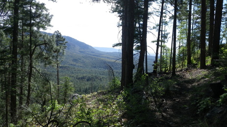 The edge of the Mogollon Rim...Turkey Springs Trail Turkey Springs trail was one of the few portions of the course I had yet discovered on my own or at some point run so this was something I was really looking forward to. We at this point were about 12 miles into the "race" and the descent down Turkey Springs would be the first real view the runners would get of the Mogollon Rim in it's full glory. And boy was it glorious. I couldn't believe it... Coming up over a tiny climb starting out on Turkey Springs you started to see the light coming through the Ponderosa Pine trees almost like when you just start to see the ocean for the first time, peaking through the trees, ominous and out there. Jay and I got closer and closer to the edge and you just knew there was going to be an absolutely epic descent coming up. I say "epic" despite it's overuse the last couple years in nearly every situation that has rendered its original meaning useless. This however...is worthy of the word "epic." We took off down the mountain, red rock trails skirting the cliff... Snakes and lizards darting off under the rocks as we flew by... Having so much fun the first thirty meters a quick yank to my left ankle was ignored and smiled off with the hundred mile view out in front of us. Sharp switchbacks in the trees swinging back out over exposed red rock ridges overlooking miles and miles and miles of beautiful views, nearly so mesmerizing they're dangerous as you run, having difficulty focusing on the trail in front of you wanting to see what's out there. 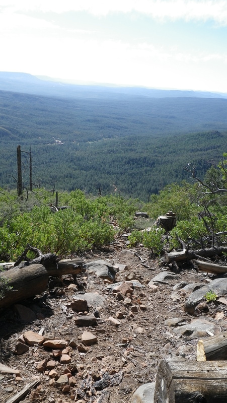
The flattest section of Turkey Springs I could risk taking a photo...
So It Begins...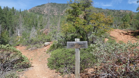 Coming down Turkey Springs and up to that point for the entire course it was well marked without having to do any additional marking for the race. Turkey Springs headed down to Geromino Trail and then the Highline Trail which takes runners all the way over to Washington Park Aid Station for the race. Jay and I had already made a one mile mistake taking the first Geromino Trail (which would have taken us UP the Rim we just came down...) and were following down a trail we believed to be taking us down to the Highline Trail. Except it kept going up. Then West. Then down. Then Up. Then West. No markers. No signage. No help. So we kept going. We'd come to an unmarked intersection and go with the most traveled course. Discouraging to say the least when you know you're adding miles on and not reaching your location. Jay was nearly out of water. We had people waiting for us at Washington Park and we still had 8 miles on the Highline to go. We were not going to make it by our ten am goal. Not even close. We finally came out of the forest at a spot I recognized. We went right down the road. We came across a huge family and Jay filled back up with water and I asked them how many miles up the road were they from the control road. "Five miles probably?" Knowing that the Zane Grey 8 Mile Aid Station was only a couple miles up the road from the control road we just had to go south a mile or so and we'd run into the Highline/Arizona Trail and head back the last few miles to Washington Park. It wasn't long before I realized they family was wrong and we were in fact already passed the HIghline and were now only a quarter mile from the control road. Super. We were not going to make 10am and by no means could make 12 noon if we had to run back up the mountain on the road to the Highline Trail intersection, 8 miles on extremely tough trail that would take almost 2 hours. Our friends would be worried being 2 hours late and would go looking for us. I knew the control road went straight to the turnoff for Washington Park. It was probably 10 miles of dirt road there and much faster than the trail. We just had to get there. So we started out on the dirt road. Uphill. For four miles. Super. We reached the intersection for Washington Park with a sign that said 4 more miles. Thirty more feet another sign said "5 Miles." Jay swears. Loudly. We shamelessly threw our thumb out at the first pickup truck that drove by. "Can you give us a lift to Washington Park?" "Kind of defeats the purpose of hiking doesn't it?" says the guy sitting on his ass driving around town. And so we went...hitchhiking our way back to Washington Park. We got out, thanked the nice people for saving us an hour of road running and we made it to our friends Honey and Kirk at Washington Park by 11:10am. Only an hour and change late. Even so, they were about to take off down the Highline to find us if we had been much longer. So despite the frustration of having lost the trail so soon in the day we are still able to continue and the mileage we had actually ran to that point was right on target with what we expected it to have been. 25 miles in the books. 6:10 (Looking back at the maps I've since discovered our error in missing the turnoff. It will be well marked so no worries there.) 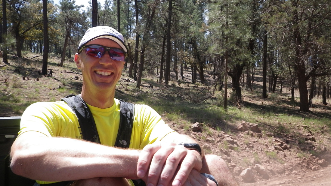
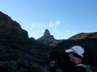
Hitching NOT allowed on Race Day!!
Cabin Loop #1 - Miles 25-48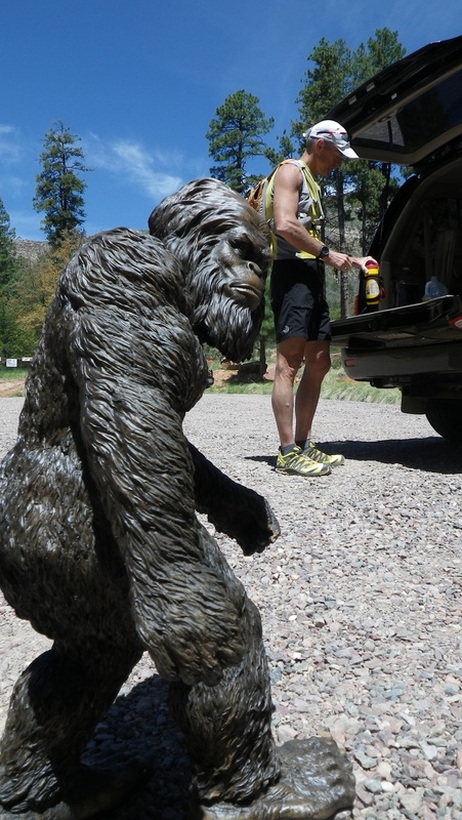 Now with a foursome of runners we head up out of Washington Park for what is the second climb of the race, a steady 2 mile climb up the Arizona Trail to the top of the Rim, finishing with a steep ascent with plenty of rocks along the ridge. Taking it along the Rim the #300 Forest Road is beautiful and it's 4.5 miles to the Houston Brothers Trail entering the forest is one vista after another. 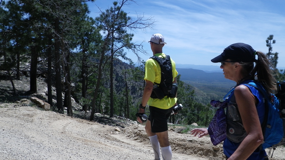
Houston Brothers Trail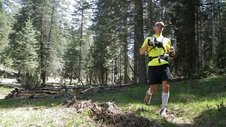 Having a section of trail this fun makes any distance seem a little bit easier. Heading north on Houston Brothers there are a few shorter hills but generally it's a gradual winding downhill in the forest, along mountain meadows, streams, rivers, and old historic cabins. It's simply amazing and even though I had thirty five miles on my body half way through this trail I felt like I had just started out for the day. I was having so much fun whipping through the trail I never wanted it to end. With the Houston Brothers Trail meeting up with the Pinchot Cabin Aid Station and then the Fred Haught Trail the awesome running keeps going for twenty incredible miles. 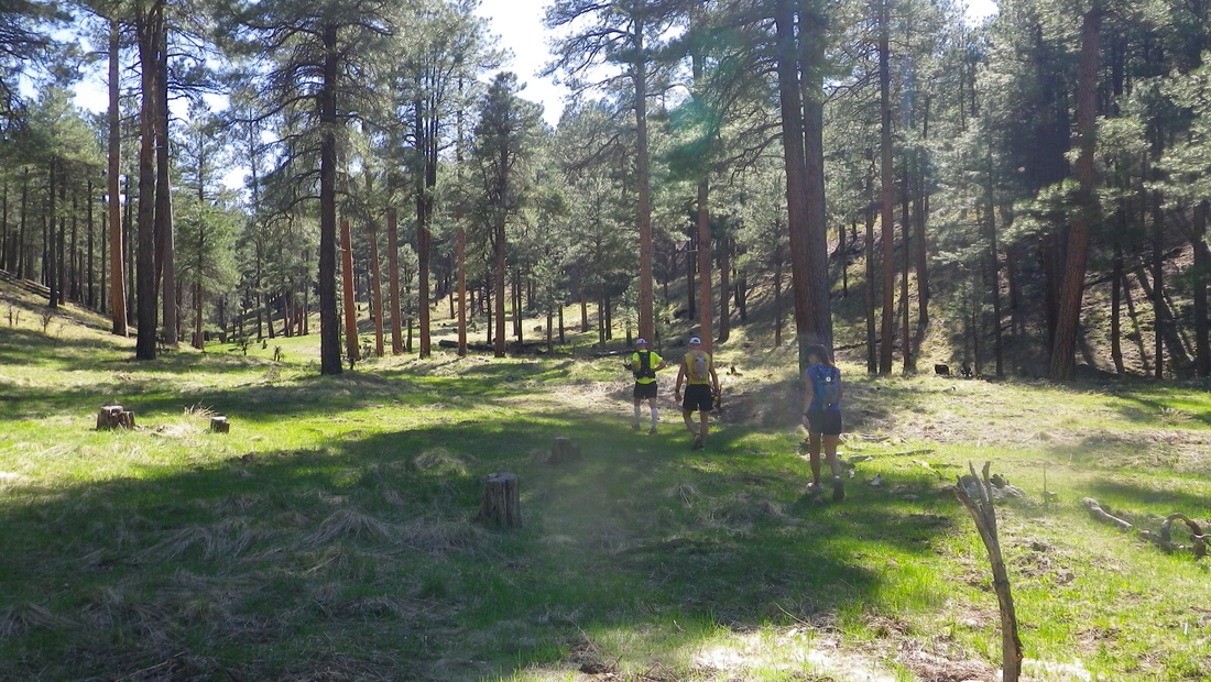
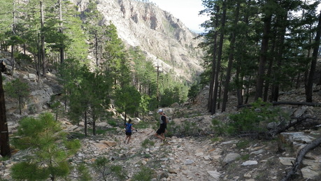
Jay leads the group along the Fred Haught Trail, approx. Mile 38.
 The Descent down Washington Park, Mile 44 We looped all the way around down the Fred Haught Trail finishing up the entire 23 mile loop in about 5.5 hours. Enter The Culpepper The Highline Trail #31 at Sunset Back at Washington Park we said goodbye to Jay and Kirk for the trip. I would be going on with Honey and newcomer Anthony Culpepper for the very long 46 mile stretch through the night. Jay was with me for the full first 48 miles and was a great motivator the entire trip and his wife Traci and their daughter Petra came and had aid waiting for us and there to help get us on our way for the next section. It's tough to see friends like Jay and Kirk take off and then head off into the setting sun to do more than twice what you've already done and it's been 12 hours already...but we did anyway. The Highline Trail is a 51 mile historic trail that is renowned for its difficulty, most notably as the setting for the Zane Grey 50 Mile race each April. This particular section is extremely rugged, rough and will usually beat the hell out of Zane Grey runners due to overgrown manzanita bushes, eroded trails, rocky as hell sections and a general undulating relentlessness that beats up the best runners every year. We'd be doing this in the dark. With 48 miles on our legs, not 17 as in where this section falls in the Zane Grey race... Then climbing the Rim straight up the Myrtle Trail. In the dark. Not exactly a motivator going into it not even halfway done for the trip. Yet I felt great. No, I felt amazing. We started off and I felt so strong, so full of energy I was excited to get this part started and push on past that level of fatigue I knew would set in again and get back on top of the Rim. I had to get past the 53 mile mark, the magical halfway mark, for no reason other than my own personal morale. The amazingness wouldn't last long and before the sun could set I was having stomach issues. The dreaded stomach issues. I'm sure it had nothing to do with the food I shoveled in my mouth at the car like my life was on the line. Ensure, Mountain Dew, slice of pizza, pretzels, Swiss Cake Rolls, oranges, cookies, and probably even mistakenly ate some plastic wrappers in the process... 
Yet despite the stomach challenges my legs felt incredible. They felt strong and alive. Anthony led the way up front, fresh and energetic, waiting for us here and there, startling the elk we came upon, snapping photos as the sun went down. With each passing minute the terrain became more and more beautiful. The red sandstone dirt and rocks became bright in the last slices of sunlight, the manzanita lost some of their daggers, softening in the darkness almost, the juniper seemingly glowing where the sun hit it's trunk. I stopped several times staring back up the Rim. Back over the valley below, back along the trail where we had come. Several times I stopped just to stand there and appreciate what we were doing. One ridge after another, down one ravine, up another, back over another ridge. The trail was relentless, driving our spirits into the dirt but with each uphill I became more charged up for the next. I became driven to keep up with Anthony, an already extremely strong runner and hiker in his own right but now also holding a 50 mile fatigue advantage on me. Either way, I needed goals. So I started running. Hard. The hills came and went and with them the sun left us. Holding off as long as I could bear it I finally pulled out the headlamp...my new nemesis for the upcoming 10 hours. Myrtle...There is something special about trail running under a full moon. There is something even more incredible when it's a "Super Moon" as it was this night. The moon was so incredibly large and bright had the trail been less rocky and technical we could have easily put away our headlamps. No question. Finally coming upon the turnoff for the Myrtle Trail was a relief itself. It was night, after 8pm already so the last eight miles took us almost three full hours on this section of the trail. Just hard to get a groove when the trail is so technically challenging, manzanita branches are out to get you and there is so much up and down in short bursts. Not to mention just being plain tired. We start the mile trek up the Myrtle Trail. A single mile yet it climbs a solid thousand feet straight up the cliff in many places. We struggled as a threesome to navigate our way up the mountain, losing the trail to the elk network misleading us this way and that until rediscovering it while branched out. After a challenging (see: shoot me in the leg and call the helicopter now) first twenty minutes we tracked down the actual trail and once that was discovered it was actually quite manageable. Or at least "manageable" in the sense that we immediately decided to take the descent of Myrtle out of the race entirely for fear of someone dying come race day. The trail is beautiful and watching Anthony trudge on up ahead of me totally lit up in the moonlight, just inches from a thousand foot cliff dropping off into an absolute abyss, Honey behind me plodding head. Just looking back at Honey the thought of coming down this trail, at night, with what would be almost 88 miles would be simply too risky, too dangerous. A fatigued runner, delirious even, would too easily mistakenly take an elk trail and find themselves lost among the manzanita, stuck on a cliffside, unable to work their way back. So you're going up Myrtle. Not down. Remember reading this when you are on the trail this fall. Some of you are probably thinking right now, "How bad can it be?" It's great going up but you'll see what I mean soon enough. The top of Myrtle was a huge relief. Even now still left with a major chunk of mileage left (57 in the books give or take at this point) I feel so much more comfortable at the higher elevations, on the "easier" terrain of the Cabin Loops and knew there was some easy forest road to knock off some quicker miles. Except I couldn't run. Or didn't want to would be a better statement. Myrtle fried me. Our headlamps were off, using the bright moonlight to work our way through the road and to the connection back into the Cabin Loop at Buck Springs, one of the Aid Stations at the race. I have a feeling this one is going to be a life saver by the time people get there at this point in the race. Coming up the road and imagining seeing the lights of an aid station, the noise, the music, the hot food. Wow would that have made the world of difference. Instead we just turned left and kept going. Back into the forest. Black, dark, Yeti infested forest. U-Bar DelusionsThis is a great section of the course and again, after leaving an aid station, some hot soup, some energetic aid station volunteers...I can see how going back into the forest can be a re-energized part of the race for many. No soup. No volunteers. No energy. Had it not been for Anthony always jumping into a trot I'd have just kept on hiking. Thank God he was there because I don't think Honey or I were particularly interested in running a several sections of the night and Anthony got us moving. We darted through the trees the two miles to the Dane Spring for a short food break. Dane Spring has a pipe with fresh water coming out of the ground. The most delicious water, I just kept drinking it, bottle after bottle. I tried my best to get down a Stinger Waffle, another gel (yeah...) and some Gu Brew. We were off and Anthony started running right away. Zero interest in running. But I did. Why? Because the forest is dark. I'm deathly afraid of getting attacked one day by a mountain lion. And because of this race I've watched pretty much every single Bigfoot/Sasquatch/Yeti movie/clip/YouTube in the world and I've now effectively freaked myself out. So I kept running knowing the person in the back always gets eaten first in scary movies. Unless you have a Black guy with you then he dies first. No black guy so I kept running. No Sasquatch Sighting YetMonster Motivation (see: the fear of being eaten by a mythical figure while running an ultra) is quite effective and I urge all of you to tap into this come midnight-4am this fall. I was flying right along and caught up to Anthony and Honey and fell in behind Anthony as we dropped down a big canyon to a beautiful moonlight mountain meadow. Crossing the river we went right back up and continued the process for some time gaining more and more elevation, dropping more and more elevation, one beautiful valley after another. And then we lost it. The trail is gone. Immediate wipeout of all motivation. Energy zapped. Caffeine now ineffective. Have no fear. Anthony is here. He pulls out a map. My head starts to spin. The temperature is dropping, probably close to 40 now as I can see my breath. My windbreaker and long sleeve shirt is grossly ineffective when one of them is soaked in sweat. Every stop creates a shivering restart. I seriously start to become concerned about my body temperature. I'm starting to cough up stuff in my lungs that wasn't there before. What is going on? Anthony finds us on a map and we start our way through the forest floor attempting to run across a forest road that leads us the back way into Pinchot Cabin to meet up with the Houston Brothers Trail again. Except it's not quite where it should be. So we trudge on. I'm convinced I see the road up ahead. I head off on my own towards the road, clear as day in the clearing up ahead and slightly down the ridge. I hike over tree trunks, in sinkholes, through the leaves and branches towards the road for fifteen minutes. It's not a road. Not even close. It's just more forest. Nothing about it any different than what we just came through. This is not cool. We keep heading towards the direction Anthony feels the road is going to be. Being the guy that solo hiked for some crazy 9 months off trail/on trail all of last year I put my trust in him and followed him along the way. Until we came out of the forest and to a road. A glorious, beautiful, smooth road. I stopped to put on my shirtsleeve shirt to go with my long sleeve and windbreaker. Gloves, hat. Still freezing cold. Cannot stop shivering. Must eat something. Kona Punch Gel? Delicious. Like cat food with butterscotch. The Definition of DemoralizingAt this point we've hit 2 am, and despite leaving Washington Park at 6:20pm where we were at 48 miles we had only traveled twenty miles. Twenty miles in almost eight hours? Shoot me. Reaching the Houston Brothers intersection was a major relief. It's those psychological checkpoints that you have to get to in these runs that are more important sometimes than the water or the food. This was one of those breakthrough locations. Because of the decision to avoid a descent down Myrtle Trail and then a return on the Highline Trail we had to reroute a similar distance along the way. Realizing that while on course the overall distance was in fact on pace to come out closer to 121 miles versus 106 we had to trim mileage off the overall course and by taking out Myrtle and the return on that portion of the Highline we can save some very time consuming and challenging terrain. Instead of taking the U-Bar Trail up to Pinchot Cabin Aid Station and down to the Barbershop Trail back to Buck Springs and down the forest road to Myrtle we'll instead go all the way back down Houston Brothers, down the 4.5 miles of forest road #300 and down the Washington Park descent down earlier in the night. Less mileage, less forest road, more Cabin Loop, and it keeps the cutoff at 36 hours. Including the Myrtle Descent and the return 8-9 miles on that rough section of the Highline would probably require a 40 hour cutoff. It's simply not quick going and especially not when you've completed 15,000+ in climbing and 85+ miles.... So we started our long trip back down the Houston Brothers trail to the Forest Road #300. Even at night this section was beautiful and Anthony once again led us off in a pace we could manage but one that kept us moving. Since the first Cabin Loop my left ankle has had this nagging pull on the outside of the ankle, likely from the quick yank coming down the Turkey Springs trail a LONG time ago earlier that day. With each step along the Houston Brothers trail it was more prominent and less annoying and more painful. It seemed to feel better running than walking so I did my best to keep up with Anthony. Until I started falling asleep. Enter 5-Hr Energy. Never try something new in a race right? Good, this wasn't a real race. Down the hatch it went. Definitely NOT sleepy anymore. Within seconds. Wide awake. Tree Trunk DelightForty five minutes later I was passed out laying up against a downed tree. They only fell 4 hours and 15 minutes short of expectations... I lay there with my eyes closed but not sleeping. I was waiting for Anthony who had gone back down the trail in search of Honey who had fallen too far behind for it to be something good. Honey can certainly take care of herself but after twenty minutes of waiting she didn't appear. Anthony went to get her. I in turn laid down in the leaves up against a tree and stared up at my eyelids afraid to actually sleep in fear of waking up to see a hairy, massive monster dripping hot saliva on my face while I lay there helpless... Sad I know. I have three night lights now. The two of them came back together, a total of forty minutes waiting by the tree. Not that I was complaining about rest, I was just happy Honey was ok. She had gotten lost after falling behind and had yelled for us but despite neither listening to music we couldn't hear her and she got off trail. The trio reunited, back onwards we went the last few miles to the Forest Road and the breaking dawn. Dawn RejuvenatesI was looking forward to the new day for some time. No headlamps, less clothes and a fresh start on the day. Four and a half miles remained of forest road before the steep descent into Washington Park where my brother Noah and friend Danny awaited to continue on with me for the last 20 some miles. I had already quit before I even got to the top of the Rim. The last four miles of forest road were walked, slow and painful. My ankle had deteriorated to agony the entire stretch of Houston Brothers and was worse with each step. Every step was a reminder of what I have remaining, a steep decline into Washington Park, eight miles along the Highline which would likely take three hours. Then another final climb up the Rim before a torturous decline only to run right past my truck into the town of Pine. I was looking at another eight hour 20 miler... Ouch. So began the miserable mind game of to continue or to not. Both Honey and Anthony were done when we reached Washington Park while I had planned to continue on to finish with Noah and Danny at the Saloon in town. Up until Honey said, "You should stop at Washington Park." There it is. The Honey Stamp of Approval. My weak state of mind was just looking for something like that. Instead I probably needed some, "You can't quit at 85 miles! That's pathetic!" I caved. Half an ankle or not I know I could have finished. It might have cost me a few weeks of running but I could have done it. Instead I jogged in behind Honey to the Washington Park with my head down, not held high as I envisioned all the day prior in the early miles. I stopped the watch at just past 7:10am, a little over 26 total hours on our feet, 85 total miles and a touch over 16,000 feet of climbing. Noah and Danny were both very understanding and after we all said our goodbyes and thank you's we drove over to the Pine Trail head and the two of them did a 4 mile out and back of the start of the Highline Trail (the finish of MOG100) while I attempted to pass out in the front seat of my truck. Over a week later I'm still disappointed I didn't finish my own race. I'm still struggling with my ankle and for the two days after the run I could barely use my left leg due to it. I'm not sure it would have been any worse had I continued on but maybe it would have been far worse. But in the end I'm still happy I ran what I did get in. I learned a whole lot in the exact areas I thought I would and many that were surprises. Obviously I found that mapping software is simply not as accurate when hand creating the map and the mileage was off which created some on the go challenges and adjustments to the course are going to be made. The elevation gain is most likely north of 18,000 feet. In terms of "Garmin" gain the climb was nearly 10,000 feet in the first 48 miles. There is likely an identical total in the second half if not more. National Geographic mapping software states 17,789 feet of gain, Garmin segments added together will likely add up to (taking out hitchhiking sections...) almost 21,000. So take that for what you will, it's a lot of climbing. Course marking really is not too challenging after a few of the major intersections are handled that created challenges in the dark and the light even for us. Many sections are very self explanatory without additional markings so after we attack these sections with some high visibility tape and markings it will be SO much easier for everyone else this fall. Aid Stations are so underrated. Not just for the food or the water re-supplies. That's easy and we carried it all ourselves but the lights, hot food variety, friendly helping faces. We lost so much time just sitting down to re-fill our packs before the next section, re-filling (gulp...) our own packs with water. All these things that during a race peppy volunteers help you out with while you fix whatever else you need. So getting in and out of each section was time consuming only adding to the overall day and that daunting timeline that kept getting later and later and later. The Monster Lives On...The one thing, if only one thing, that I'm left with after this experience, is that this course is incredible. Really. I read every running magazine out there. I've seen every Vimeo and YouTube video on trail running. There are some incredible places out there, some amazing trails. I really think this is one of those places. The Mogollon Rim is enchanting, mesmerizing. So rugged, so majestic. So many places have higher elevation, steeper cliffs, bigger trees, smoother trails. But the combination of everything this course throws out at the runners is going to make it one of the most challenging and beautiful races in North America. The stigma it received right away that it is a "Double Zane Grey" is simply not accurate. There is too many beautifully smooth sections on the Cabin Loop or short reprieves on the forest roads to get anywhere close to what it would be like doing a Double Zane Grey. Is it harder than doing a Double ZG? Maybe. Probably. But not quite as rough on your feet as that would be. June, July and August I'll be planning training runs for three different 25 mile sections to give everyone a chance to see the course. We'll start in early June (hopefully June 2nd) with the first 8 miles and the descent down Turkey Springs, return up West Webber to the top and back down Donahue. It'll be the first 15 and last 8. July we'll do a 23 and 31 mile route of the Cabin Loop and in August we'll have Highline>Myrtle>Barberhop sections among others to choose from. www.mogollonmonster100.com Check it out. See you out there! 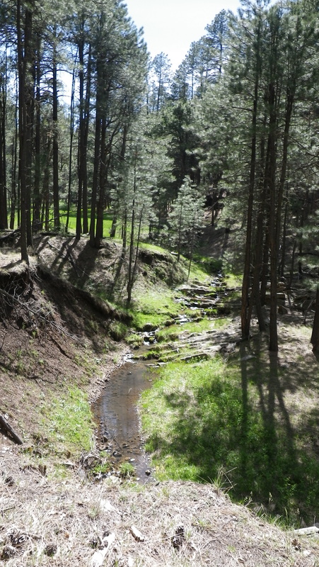 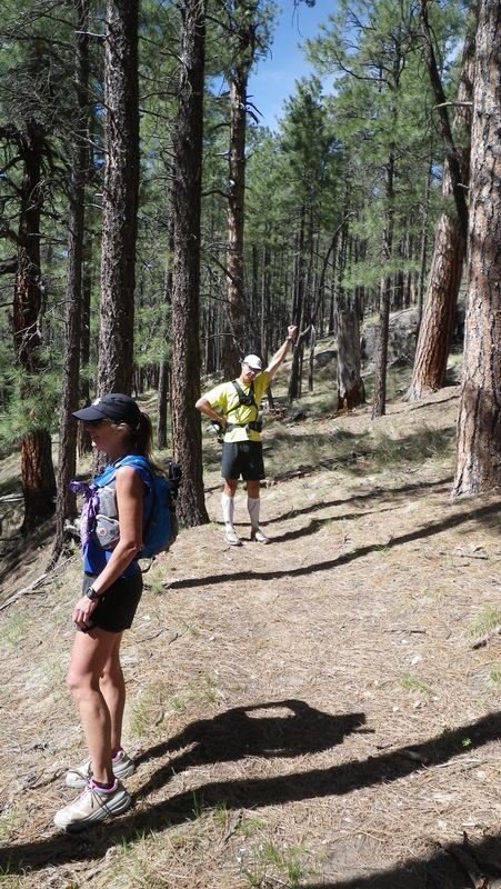  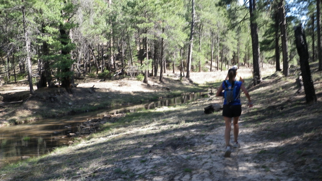 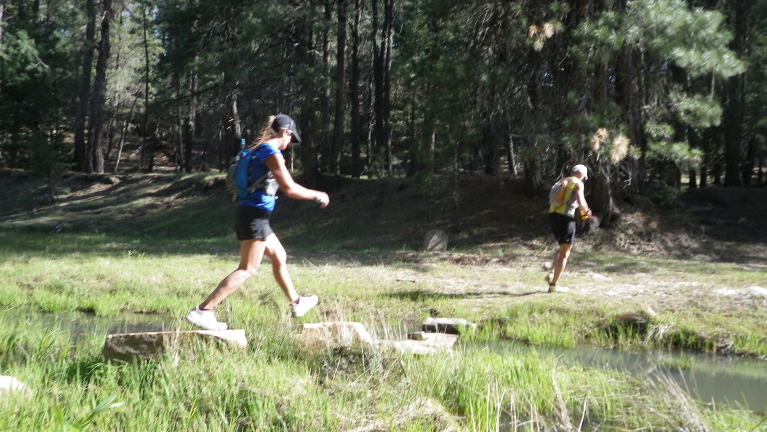 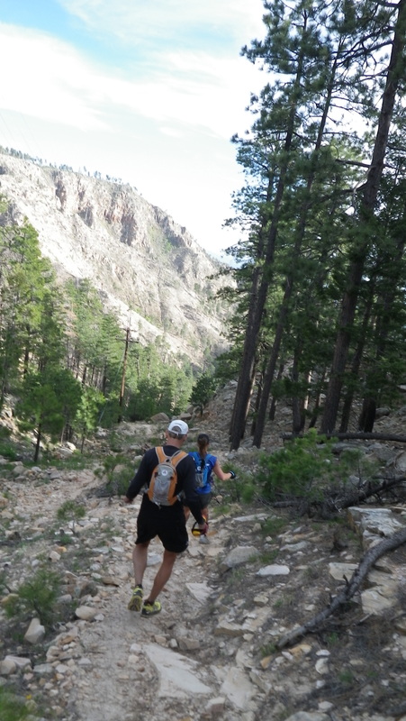 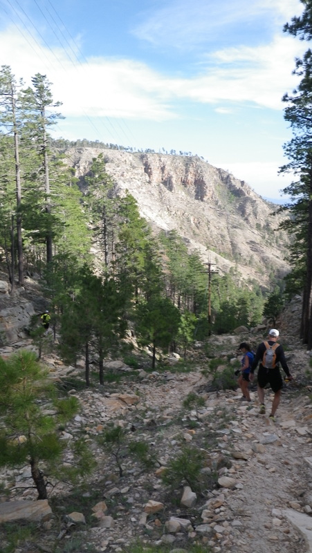 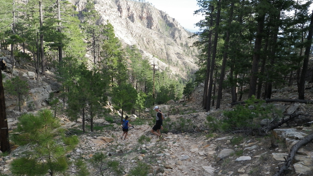 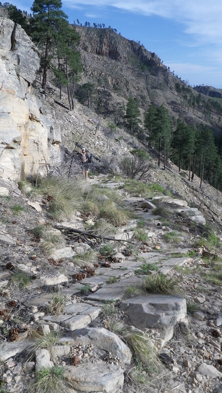 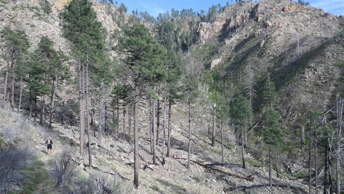  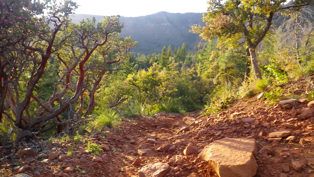 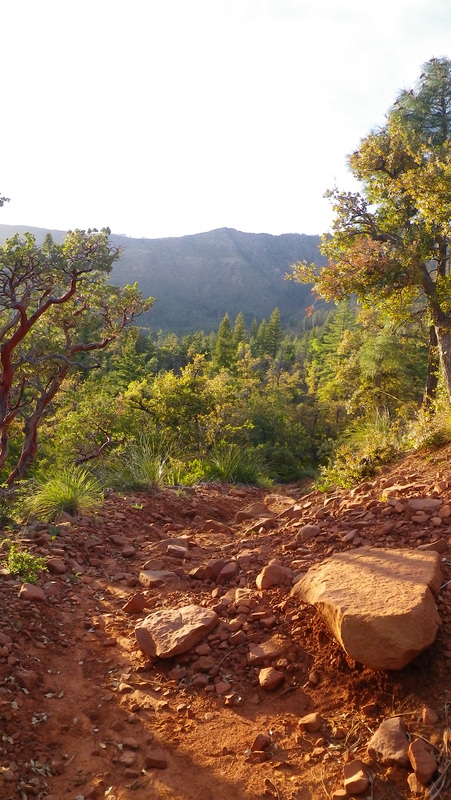 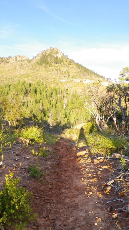 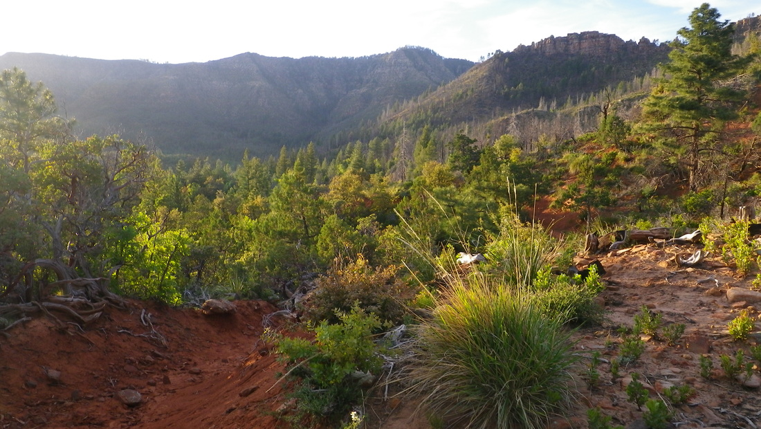    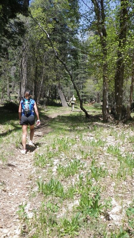 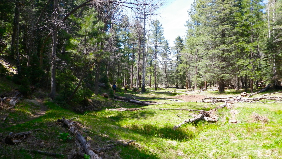 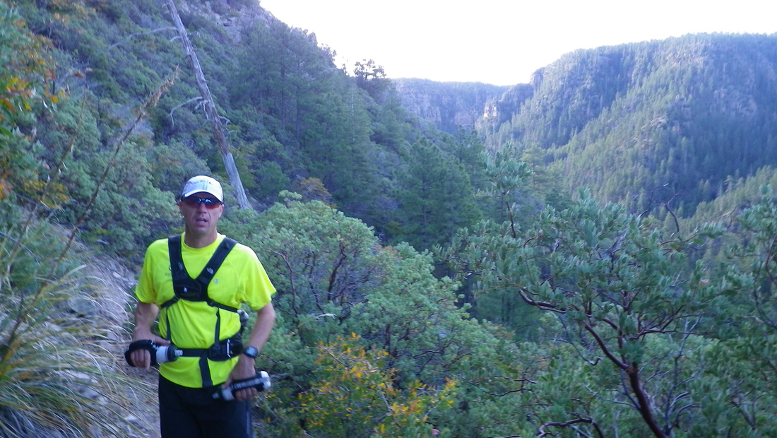 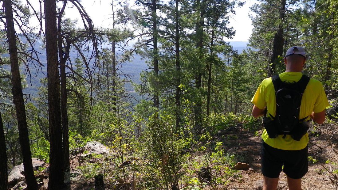 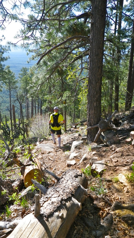 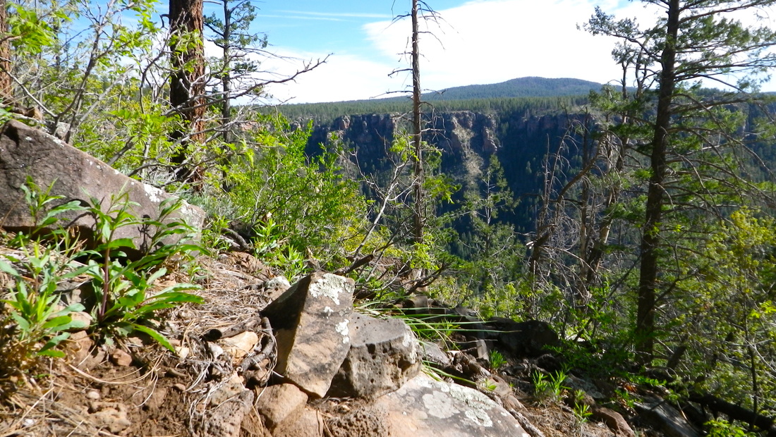
0 Comments
|
 Archives
September 2019
Categories
All
|